On New Year's Day, in 1908 Ernest Shackleton set out with his men on their ship the Nimrod, for an ambitious expedition (Shackleton admits as much in his journal). The original plan, as stated in the
Geographical Journal (March 1907):
The shore-party of nine or twelve men will winter with sufficient equipment to enable three separate parties to start out in the spring. One party will go east, and, if possible, across the Barrier to the new land known as King Edward VII Land, follow the coast-line there south, if the coast trends south, or north if north, returning when it is considered necessary to do so. The second party will proceed south over the same route as that of the southern sledge-party of the Discovery; this party will keep from fifteen to twenty miles from the coast, so as to avoid any rough ice. The third party will possibly proceed westward over the mountains, and, instead of crossing in a line due west, will strike towards the magnetic Pole. ... I do not intend to sacrifice the scientific utility of the expedition to a mere record-breaking journey, but say frankly, all the same, that one of my great efforts will be to reach the southern geographical Pole.
 |
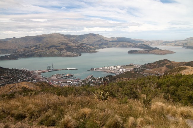
| Present-day Lyttleton. Photo credit: Dan Sutterfield |
By March 9 of that year they had ascended Mount Erebus, the active volcano on Ross Island, and taken the first geologic samples. They did traverse to around 100 miles from the geographic pole, which was the farthest south achieved at that time. Part of their party also made it to the magnetic pole. Sounds like a pretty successful season to me! The exploring community at the time thought so too, though the Royal Geographical Society dragged its feet a bit before awarding him a medal. I'm finding Shackleton's expedition journal,
The Heart of the Antarctic, a fascinating read
.
 |
| Lyttelton in 1955. Photo credit: Dave Grisez, NSF |
Lyttelton has served as a jumping off point for many subsequent Antarctic expeditions, including the ships carrying goods to set up research stations in the first year of the US Antarctic Program's Operation Deep Freeze in 1955. The following bases were established: Byrd, South Pole, Wilkes, Ellsworth and Hallett. Williams Field, onto which I flew last week (see 12/25/14 post), was also built in 1955, making the first flights to Antarctica from another continent possible.
 |
| People gather in Lyttleton to see the ship off to Antarctica in 1955. Photo credit: Dave Grisez, NSF |
 |
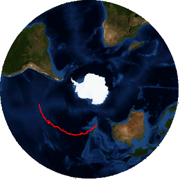
Path of a long-duration balloon
launched earlier this season.
|
There is another exciting event to report this New Year's Day. A NASA group launched a balloon from McMurdo. Untethered, the wind will carry it for days or weeks until it falls back to the ice surface. The scientists exploit circulation patterns in the summer which might bring it full circle, close to its launch point. According to NASA's
website, "
These balloon flights carry the balloons and their instruments at the edge of space and are used to investigate the nature of ultra-high-energy cosmic rays and search for anti-matter, as air currents that circle Antaratica."
 |
SPIDER launched 1/1/15
|
 |
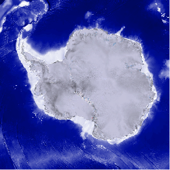
| SPIDER path |
|
|
|
|
|
|
| Payload position as of: | 21:02:47Z 01/01/15 | Latitude: 78°45.92 S | Longitude: 160°55.39 E | Altitude: 120030 Feet | 17.00 Knots @ 245.00° |
During the last week I have been thoroughly brought up to speed through many briefings and trainings. The Antarctic Field Safety course is a refresher course that covers some of the outdoor skills I learned last year in the Happy Camper course. Although it doesn't involve camping outside, we did have a trial run using the Whisperlight stoves, setting up all of the possible mountain tents that we may be issued, and practicing our knots. As part of this training we were shown a powerpoint on cold weather injuries which contained a lot of useful information as well as some grisly photos of extremities to motivate you to avoid these injuries. The Fire Safety course was particularly important because the dry climate and strong winds can cause fires to spread rapidly. There were also many reminders of the unique recycling system used here to minimize the amount of garbage we need to send back to California on the ship.
 |
| My office in Crary Labs |
Most of my time has been spent in my office in Crary Labs, but I have gotten the chance to do a few hikes these past couple days. A crack in the sea ice has developed where seals and penguins are emerging for a rest on land. The weather has been lovely the past couple days: just a few degrees below freezing, clear skies, only a light breeze.
Perhaps the most exciting bit of news for me is that five of the scientists on our team made it out to the field site today. I hope to follow them with the rest of our team in a few days. Let's hope the nice weather holds!
 |
| Me and McMurdo Station. Hut Point is the promontory on the far left. |
 |
| Halfway up Observation Hill (I did hike up the rest of the way) |
 |
| The crack in sea ice from Hut Point. Black dots are seals. |
 |
| Weddell seals and Adelie penguins |
 |
| Me and Mount Erebus, smoking away |


No comments:
Post a Comment